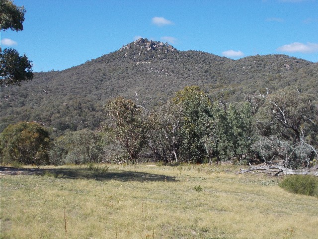
Gibraltar Peak, taken from the Birrigai Time Trail
Gibraltar Peak, taken from the Birrigai Time Trail
On Monday 15th January 2018 I joined up with workmate Matty Davies for a one day walk in Tidbinbilla Nature Reserve. This is to be the first of several walks we have planned here for this year. After several days of oppressive Canberra summer heat it was relieving to find the temperatures had plummeted this morning. The forecast temperature was for a maximum of 25 degrees celsius and a clear sunny day, perfect bushwalking weather.
Matty arrived at my place in his car at 8.45am and immediately tried on a couple of pairs of my older bushwalking boots and found a set that fit him perfectly. Much better than the steel capped monstrosities he had been wearing before today. By 9.00am we were in my car and driving to the south-west of Canberra, down the Cotter Road past the camping area near Cotter Dam and off along Paddys River Road, passing the deep space tracking station to Tidbinbilla Nature Reserve where we pulled up in the Visitor Information Centre car park. After purchasing an annual visitors pass we drove into the park for about 2km, arriving at Dalsetta Car Park where a number of walking tracks begin. By this time we had decided to do the walk to Gibraltar Peak, leaving the longer walks for cooler months later.
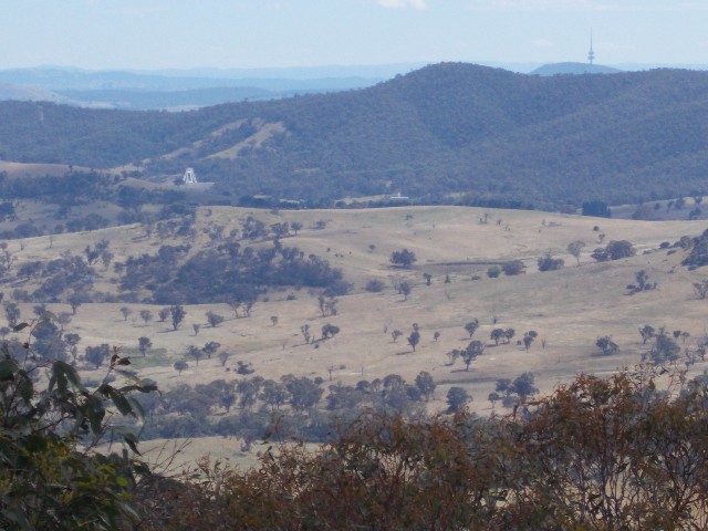
View from the track, just below the summit looking east towards Canberra
It was 9.55am when we crossed the road and signed the walk register, noticing a few walkers had already left for this walk today. The sky was clear and the temperature was still quite low as we set off along the faint walking track that had many interpretive signs and guideposts. You had to be really stupid to get lost on this trail. We followed the track through grassland noticing many eastern grey kangaroos resting in the shade of small trees. Matt and I discussed the possibility of coming across snakes today and although we kept ourselves alert to movement along the track we did not see one single snake during the walk to and from Gibraltar Peak. The track became well defined very quickly with metal mesh walkways through the low wet areas, but soon we found ourselves ascending gradually through eucalypt forest as we reached the lower slopes of Gibraltar Peak.
The track from here ascends quite steeply up the slopes, but it is mostly unnoticeable as the trail zigzags in a vast number of benches and hairpin bends that keeps us mostly on a gradual incline, quite enjoyable and although it got the cardio working we hardly found ourselves stopping to catch our breaths. There was also plenty to see along the track. The plant life was vast along with interesting rock formations. There were numbers of grass trees on the trackside. The 2003 fires came through here and reduced the vegetation on the peak almost to ash and there is still graphic evidence in the many blackened tree trunks along this route, though there are obvious pockets of vegetation that survived.
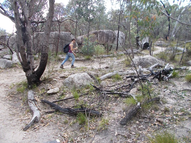
Matty makes his way along the track around which still shows evidence from the 2003 bushfires
At one stage the trees gave way to a nice view to the north north west of a large peak that I guessed to be (and later found correctly) Pearces Hill, accessed by following the track to Camels Hump and beyond (one of the walks we planned to do in future) One of the hairpin bends revealed a rustic picnic table in a small clearing that I noted may make a great stopping place on the way back should it be required. The trail continued upwards though still hardly noticeable. A long flat section took us along the eastern flank of Gibraltar where we had mostly tree interrupted views of the plains below. In the distance we could see Black Mountain and it's famous telecommunications tower. Closer to our location we could pick out the dishes of the Tidbinbilla Deep Space Tracking Station.
The trail now gets steeper as we finish our main ascent to the top. The track still zigzags but at a steeper incline between large boulders and utilising several stone steps, passing a nice little viewing platform next to several imposing granite boulders. In the right season you would enjoy the many flowering orchids here too. This mountain was used by the local aborigines for initiation and education purposes.
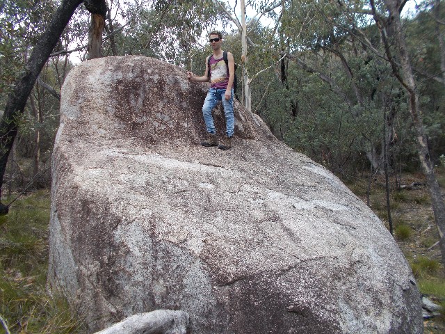
Matt poses on one of the large granite rocks found on the trackside
Near the top the steep walking finally had the huff and puff effect, but still not as bad as I expected, certainly not in the Mt Tennent class. The grass trees are in abundance here as are the interesting rock formations. We pass one of the early bird walkers coming back down and continue on, eventually coming out onto a forest road below the southern summit. The road section is only a few metres before we find ourselves on another signposted track as the stone steps take us steeply to the top and a large granite rock platform dominated by two marble-like rocks. We stop here to enjoy some photographs of the views before heading off to explore.
The granite ledge at the Gibraltar Peak summit
Small tracks lead us through large rock boulders to rock ledges to the south that give more excellent views. I noticed that it had taken us only 70 minutes to get here from the car and that was just plodding along. At this rate we could return to the car to have lunch, but I decide the rustic looking picnic table near the bottom would be a nicer spot. We start our return almost immediately, discussing other walk possibilities as we descend. We have views on the smaller hill to the north, Mount Eliza, where our route takes us between these two high points. Eliza still looks rather bare, the trees struggling to grow taller than the scattered rocks around its summit, obviously revegetation since the 2003 fires has not been overly kind.
The descent was quick and uneventful, perhaps because we were too busy chatting about other things rather than taking in the surrounding countryside. We passed a number of hikers coming up and we noticed the day had become overcast but still pleasant. It's been rare that a climb can be found to be this comfortable and the descent was akin to a walk in the park. We stopped at the picnic table to enjoy an early lunch. For me that included a couple of bananas and a low carb bar washed down with water.
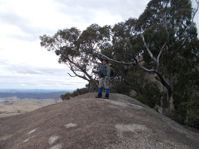
Paul at the Gibraltar Peak summit
After 20 minutes we shouldered rucksacks and finished the walk. Passing the eastern grey kangaroos near the bottom. Arriving back at the car at 12.20pm we agree to drive further into the reserve and spent the rest of our day here doing the civilised touristy walks through the Koala enclosure and Eucalypt walk where we got glimpses of long nosed potoroos and a yellow tailed black cockatoo before we took the longer walk through the animal sanctuary with its lakes and boardwalks, coming across three red belly black snakes on the trailside in less than 100 metres. We did much of the circuit trail before we headed back to the car and drove home.