![]()
|
Botanical Research....Denise Black Msc
Project Coordinator....Elaine Atkinson
Layout & Assistance....David Reynolds (e-mail
contact)
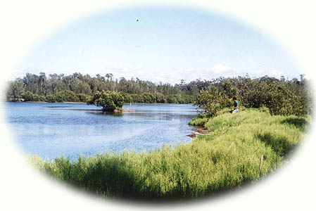
An Ecological study of Pat's Bay, St Georges
Basin, NSW Australia.
Produced for ACF Shoalhaven Branch and the
St Georges Basin Community Forum.
Click here to see Pat's Bay Wetland location Map.
GENERAL DESCRIPTION
This wetland is a small embayment in the north-western corner of St. George's
Basin. The embayment extends into a narrow-necked lagoon at its landward
extremity.  Reduced tidal flushing can be held partly responsible
for a build-up of sediments evident at the mouth of the lagoon. The resultant
large area of shallow water supports luxuriant eelgrass beds, alive with
small fish. It is in this area that the man-made canal enters the embayment.
Reduced tidal flushing can be held partly responsible
for a build-up of sediments evident at the mouth of the lagoon. The resultant
large area of shallow water supports luxuriant eelgrass beds, alive with
small fish. It is in this area that the man-made canal enters the embayment.
Extensive mudflats along the margins of the embayment and the lagoon support zones of salinity-tolerant wetland vegetation. Further seawards, fossiliferous Wandrawandian siltstone forms a rocky margin to the mudflats.
VEGETATION
There is a gradational change in vegetation from the western end of the
wetland, no doubt reflecting increasing salinity. At the landward end of
the lagoon, the Common reed, Phragmites australis is abundant, indicative
of fresh to brackish conditions. At the seaward end, beds of Hormostra (Neptune's
Beads) indicate seawater.
ZONES
A variety of salt-tolerant species form zones on the 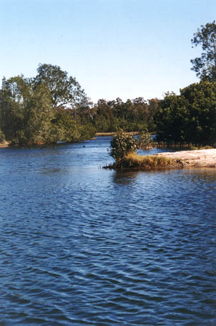 mudflats, in response
to changing conditions of salinity and of tidal inundation. These vegetation
zones are diagrammed in Figure 2 and briefly outlined below.
mudflats, in response
to changing conditions of salinity and of tidal inundation. These vegetation
zones are diagrammed in Figure 2 and briefly outlined below.
Common Reed (Phragmites australis), forms a dense reedland at the western extremity of the lagoon. The presence of this reed indicates that the water at this end of the wetland is more or less fresh, that is, tidal flushing does reach here.
Mangroves edge the mudflats throughout the wetland, in a belt of varying thickness.
Melaleuca ericifolia forms a zone behind the Mangroves in places.
Juncus rushland grows along the water margin in parts of the lagoon.
Samphire (Sarcocornia quinquefaria) and Seablite (Suaeda australis) forbland grow on mudflats on the landward side of the mangroves.
Swamp Oak forest (Casuarina glauca) bounds the wet-land on the landward side of the salt-tolerant species.
Swamp Weed (Selliera radicans) closed forbland,
Saltwater Couch grassland, or
Common Reed cover patches of swampy ground near the Swamp Oak forest.
Open Eucalypt Forest occupies Crown Land behind the Casuarina glauca zone, on both Tallyann Point and Pelican Point. This forest buffers the wetland from the effects of development. It has largely already been cleared from the area currently under assessment.
Click here to continue.
|