SIGNIFICANCE OF SHALLOWS
Eelgrass (Zostera muelleri) is extensive and luxuriant in the
shallow waters of Pat's Bay. 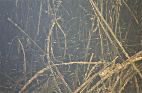 Eelgrass provides shelter and food for small fish. It's presence
is a significant indicator of the viability of this wetland as
a fishbreeding habitat. Eelgrass is light dependent and hence
needs shallow, clear water to flourish. It grows to a maximum
depth of about 4.5 metres in clear water.
Eelgrass provides shelter and food for small fish. It's presence
is a significant indicator of the viability of this wetland as
a fishbreeding habitat. Eelgrass is light dependent and hence
needs shallow, clear water to flourish. It grows to a maximum
depth of about 4.5 metres in clear water.
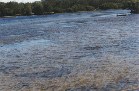
Fisheries Importance of Area Adjacent to Canal Development
Small fish were observed to be present in abundance in the area
of shallow waters at the entrance to the lagoon and canal subdivision.
Their presence is directly related to the shallow waters and their
eelgrass beds. Loss of either shallows or eelgrass would predictably
decimate small fish numbers.
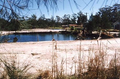
LIKELY CONSEQUENCES OF DEVELOPMENT
Water pollution is highly likely to result from any development
adjacent to the wetland.
Types of water pollution likely to result from increased development:
- (i) Major silt input from any soil disturbance associated with land clearing or earthworks.
- (ii) Stormwater runoff, carrying silt, oil, gutter trash.
- (iii) Pollutants from boats, including oil, paint, metals, sewage, sullage, flotsam and jetsam.
 Effect on Eelgrass/Fishlife:
If water becomes cloudy from silt and clay minerals, reducing
light levels, there will be a consequent reduction in eelgrass.
In turn, fishlife which depends on eelgrass beds for its survival
will be decimated. This in turn will affect the larger wetland
species, such as the wide variety of waterfowl and wading birds
which frequent Pat's Bay.
PLANNING STATUS
State Environmental Planning Legislation:
SEPP 14 wetland No.322 occurs at Pat's Bay. This is a designated wetland, and as such requires an Environmental Impact Statement, (EIS), for any proposal likely to affect it.
Shoalhaven City Council Management:
 The canal development adjacent to Pat's Bay wetland has been zoned
2C. The siting of a 2C residential area and boating facilities
adjacent to (and virtually in) a SEPP 14 wetland is contrary to
Council's own management recommendations, as laid down in the
St Georges' Basin Estuary Management Plan 1995.
The canal development adjacent to Pat's Bay wetland has been zoned
2C. The siting of a 2C residential area and boating facilities
adjacent to (and virtually in) a SEPP 14 wetland is contrary to
Council's own management recommendations, as laid down in the
St Georges' Basin Estuary Management Plan 1995.
St Georges' Basin Estuary Management Plan 1995:
This document lists recommended management strategies relevant
to any development proposed in the vicinity of Pat's Bay wetland,
including the following:
(i) "Provide environmental protection zoning to land draining into or adjacent to sensitive estuarine habitat".
(ii) "Provide 100 metre buffer zones adjacent to wetland areas.
(iii) "Ensure walkways and boating facilities are not sited in sensitive areas".
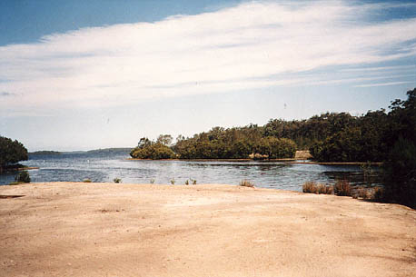 As the management plan states, the wetland and peripheral vegetation
of St. Georges Basin are significant. It represents one of only
three large water bodies on the South Coast of NSW (others are
Jervis Bay and Lake Illawarra) and its fringing vegetation is
largely undisturbed. It supports a significant proportion of the
South Coast seagrass area: 1.7 times the seagrass area of Lake
Illawarra, being 22 hectares per square kilometre. Lake Illawarra
supports 14 hectares per square kilometre and Jervis Bay 9 hectares
per square kilometre. Thus St. Georges Basin is ranked as the
most productive estuary on the South Coast, above Lake Illawarra
and Jervis Bay.
As the management plan states, the wetland and peripheral vegetation
of St. Georges Basin are significant. It represents one of only
three large water bodies on the South Coast of NSW (others are
Jervis Bay and Lake Illawarra) and its fringing vegetation is
largely undisturbed. It supports a significant proportion of the
South Coast seagrass area: 1.7 times the seagrass area of Lake
Illawarra, being 22 hectares per square kilometre. Lake Illawarra
supports 14 hectares per square kilometre and Jervis Bay 9 hectares
per square kilometre. Thus St. Georges Basin is ranked as the
most productive estuary on the South Coast, above Lake Illawarra
and Jervis Bay.
CONCLUSIONS
As stated in Shoalhaven City Council's 1995 St. Georges Basin Management Plan, the wetlands of St. Georges Basin are the most productive on the South Coast. They are of high significance for the survival of fishlife. This is in addition to their intrinsic value as natural wetlands, supporting a wide variety of life.
This environment is in a fine state of balance. Vital to its continued existence are shallow water and water clarity. Any form of development adjacent to Pat's Bay is highly likely to cause increased sedimentation and other forms of pollution, thus affecting its viability as a wetland and as a fishbreeding habitat.
It is believed, therefore, that the recommendations made in Shoalhaven Council's Management Plan 1995, should be followed through. These include environmental protection zoning of adjacent lands, provision of buffer zones, retention of vegetation corridors and prohibition on the siting of boating facilities or walkways in sensitive areas.
D. Black MSc (Plant Ecologist) 24/8/97
|