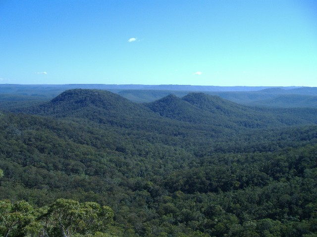
The Three Peaks, taken from the cliff edge near Old Burrier Fire Trail on a previous walk. Left to right - Mt Barron, Hanson Hill & Grady Hill
Wednesday 23rd July 2008 found me joining up with 23 other members of the Shoalhaven Bushwalkers for the Three Peaks Walk near Coolendel west of Nowra. The walk was being led by Sue Josephson and was billed as 'Past Her Peak' due to the fact that Sue hadn't led the walk for many years. In fact I had not done the walk since Sue last put it on for the club in 2003. The walk is noted as a club classic and it's certainly on my list as one of the 5 best day walks in the Shoalhaven district. The Three Peaks can be seen from the cliff edge near the Old Burrier Fire Trail, just before we descend toward McKenzie Saddle on the Two Rivers Track. The weather couldn't have been better for today's walk, sunny, clear skies, but quite cool.
The Three Peaks, taken from the cliff edge near Old Burrier Fire Trail on a previous walk. Left to right - Mt Barron, Hanson Hill & Grady Hill
Apart from Sue there were plenty of familiar faces on today's walk. Jock and I travelled from my place to the start of the walk at Grassy Gully. The drive west of Nowra brought some interesting sights as the unsealed road followed the cliff line above the Shoalhaven River before heading inland and winding its way along the side of the ridge before descending past the old abandoned Grassy Gully gold mines which have been covered by strong metal mesh or fenced off to prevent the unwary from falling into the deep pits. Jock and I arrived at the small parking area, once a campsite at 9.35am, just 5 minutes before the rest of the walking party arrived from Nowra.
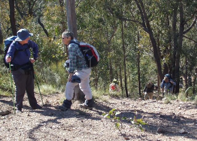
We set off almost immediately, heading northwards along the unsealed road towards Coolendel, ascending gradually until we reached an intersection. Straight ahead is signposted to Coolendel and the camping area on the Shoalhaven River. We turned left and followed Yalwal Creek Road as it climbed to Moffatt Saddle. Despite the cold morning air, the climbing so far was steep enough to have several of our group removing their fleece jackets or jumpers. Just past Moffatt Saddle we turned off the road onto a narrow track on the left which climbed steadily through the burrawangs until suddenly we were faced with a very steep 50 metre climb onto the ridge top. I still have vivid memories of scrambling up here on my previous two visits, my lungs screaming for more air and my leg muscles tightening up like an archer's bow as we scrambled up, almost on our hands and knees on the very steep loose gravel covered slope. It was much the same this time around, though I think I handled the climb much better than on previous attempts, being in the first group to reach the top. I think the fact that I'm doing much more regular walking with the club this year than in the past has certainly helped.
Chris & Sue take a breather at the top of the steep climb as others struggle to the top
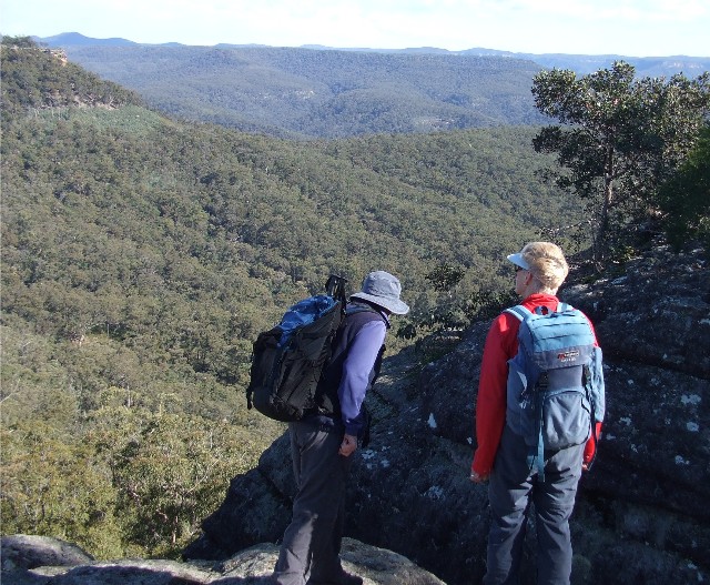
At the ridge top my legs felt like jelly as I caught my breath and enjoyed the 360 degree views from this vantage point. I could look down onto the Shoalhaven River and across to Mount Scanzi. I could look west across the Yalwal Creek Valley towards the Ettrema wilderness while to the east I could look down onto the Burrier Sand Quarries. We encouraged the back group as they struggled up the last section, Jock bringing up the rear in his usual duty of 'Tail End Charlie'. We sat down in the sun and enjoyed morning tea. I noticed now that only a few of the group still wore their fleece jackets and these would be removed very shortly during the next ascent.
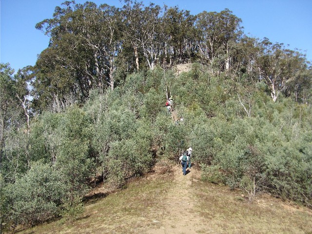
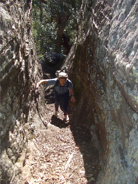
The ascent up to Grady Hill from the saddle
We now headed southward along the ridge top towards Grady Hill. A faint track led us across the top where the ridge sloped down on either side, leaving a very narrow path on top. The track descended to a small open saddle before ascending steeply once again. An approximate 50 metre gain in height over a small distance, though not as steep as the previous climb. Once near the top, the ridge flattened out as it passed by several rocky outcrops, then over to an open area just below the top of Grady Hill. Here we waited for the slower back group to catch up.
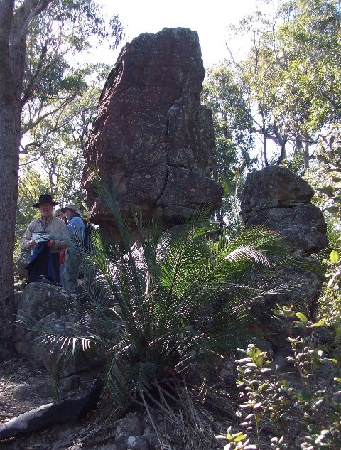
Alf poses by an impressive rock formation near the top of Grady Hill. A lone burrawang palm dominates the foreground
We were standing near what I remembered to be a narrow pass onto the top of Grady Hill, a route we had taken on that very hot day in September 2001. Strangely Sue couldn't remember this pass and I remembered that when she last led this walk in August 2003 we had missed this pass and continued around the base of the cliff line. Sue was keen to repeat the 2003 route, but she allowed me permission to lead a small group who were very keen in following the route across the top while Sue led the rest along the base of the cliff line. Next to a hollow cave-like feature is a narrow chute that can be scrambled up onto the top. It's much easier than it looks and soon I'm standing at the top and waiting for the rest of my party which included Lani, Peter, Alf and Ross. The top of Grady Hill was covered in light forest and there was very little undergrowth, so the going was very easy. Within less than 100 metres we came to another pass which looked very simple to climb, just as Sue and the rest of the group arrived below us. They suddenly decided to come and join up with my group on top of Grady Hill. The only problem was that there was one section that was proving difficult to climb over, so I scrambled down to give several of the group a hand in climbing up. Overall I think Sue's group took the harder option, but everyone was finally together again.
Lani scrambles up the chute onto the top of Grady Hill
Grady Hill was very narrow here and the eastern cliff line gave some great views across the Shoalhaven. We could pick out Coolangatta Mountain, Browns Mountain and even Nowra Hill in the distance. Another view included the plateau near the Old Burrier Fire Trail to the south where we normally get great views of this very site. We now made our way south across the top to the southern edge where we should find the pass back down to the track. We had no trouble finding it, but first we stepped onto the rock platform to take in more views to the south which included our next objective, Hanson Hill.
Chris and Sue inspect the pass off Grady Hill from the southern cliffline
The descent through the pass off Grady Hill is narrow and a little steep, but if you tread carefully and use all hand and footholds there shouldn't be a problem. The hardest part of the descent in my view was negotiating the dead fallen tree at the bottom of the pass. Once on the track we again descended to another saddle, then ascended to below Hanson Hill where we had another rest stop. This is a chance to drop packs here and climb to the top of the hill for more views. I decided to stay behind with the group that didn't want to go up as I'd been there on a previous hike. Jock decided to take the slower group on to the base of the cliffs of Mt Barron and wait for us there, rather than have them slowing us down further.
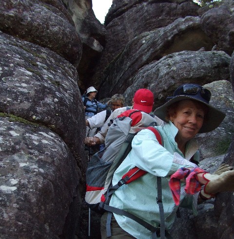
Robyn leads a group through the pass off Grady Hill
It wasn't long before everyone had climbed down to join us and we set off, again following the faint track to Mt Barron. The track initially descends, quite steeply too, requiring the use of trekking poles to gain purchase on the very slippery and loose surface. Once we reached the saddle we started another steep climb to the base of the cliff line on Mt Barron. The track here is less than defined, but if you head for the highest point of the ridge you can't go wrong. About halfway up the ascent I turned around to get a great view of both Hanson and Grady hill to the north, a rare sight without the bulk of My Barron in the way. We caught up to Jock and his little group on top of the ridge just below Mt Barron's north eastern point.
In the past, there have been two ascents through the cliff line onto the top of Mt Barron. The hardest, which includes a scramble up a rock chimney is very close to the north eastern end of Mt Barron. I suggested that those who would prefer the easier pass to the top follow me as we made our way westward below the cliff line to the pass which is only about 50 metres away. A few minutes later I was quite surprised when I turned around and found everyone else, bar Alf (who had taken the harder route to the top) had decided to follow me. Several commented that perhaps my calculations were a little out. We seemed to have followed the cliff line for closer to 100 metres and we were still not close the pass I wanted. I think they were right, my only excuse being a 5 year hiatus between walks that always seems to shorten the distance in your memory. I'd say it's closer to 150 metres and by then I was starting to worry I might have bypassed the spot. However, after scrambling through a section of thick undergrowth and loose rocks we arrived at the bottom of the pass I was looking for. Was this easier? At first glance I felt embarrassed enough to think I may have led the group to the wrong spot. The only way to find out was to scramble up and check it out. Halfway up I recognised the large rock stuck in the middle of the narrow passage that we would need to negotiate and once over that I could see the cairn at the top of the pass. Suddenly Alf was on the rock above me calling everyone up. I dropped my pack near the top then returned to the middle of the pass to help everyone else scramble up over the difficult section.
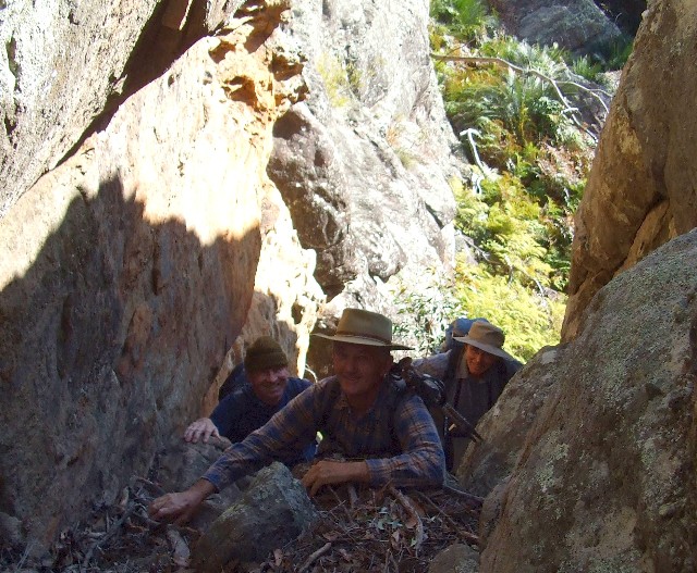
Jock, Ross and Peter scramble up the pass onto Mt Barron
We had lunch on the rocks just above the pass. Here we had great views to the north of the Shoalhaven River Valley and we could look down onto the twin hills of Hanson and Grady. Once lunch was over we made our way across the rocks to the north eastern point for more views, then we made our way south through the forest of eucalypts and burrawangs to the southernmost point of Mt Barron and Bundundah Trig. The trig is still in very good condition compared to many others of this type found in the wilderness areas of the Shoalhaven. The cairn of rocks still holds a tall wooden post at the top of which is a complete metal trig vane. Theses trigs are usually in bad state of repair with the wooden posts burned by bushfires and the vanes broken and scattered around the site. The usual trig photographs were taken prior to taking a look at the views from the southern end of the mountain which included the plateau to the south and Durkin Spur.
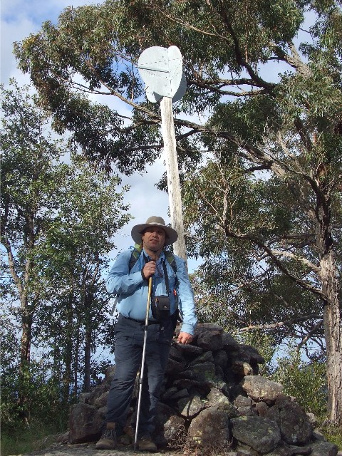
The Author at Bundundah Trig on the southern tip of Mt Barron
We now headed back northwards, keeping close to the eastern cliff line to locate another pass down to the forest below the cliff line. We didn't have far to go, though several were fooled by a false descent that ended with a steep drop too dangerous to contemplate for some of this group. The pass we were looking for was just a little further north. It was steep and loose, but there were plenty of hand and footholds. Once down the bottom we realised we were a few short. Tony climbed back up the pass to locate our missing group which turned out to be a couple of photographers wishing to take snaps of a burrawang with two very distinct pineapple shaped seed pods. Admittedly a rare find, especially at this time of year. However, the photographers did test the patience of Jock who was responsible for those at the back of the group. He was not a happy chappie as he descended the pass, threatening untold damage to the next camera he saw.
We now scrub bashed our way around the base of the cliffs to the point below the southern tip of Mt Barron and located the track that descends to Banfora Saddle. This track is just as steep as the descent from Hanson Hill and once again trekking poles were put to good use to steady the feet and knees on the loose surface. Several of our group took embarrassing tumbles, but no one was hurt with the exception of pride. The descent seemed to take ages but eventually we reached the knoll on the northern side of Banfora Saddle. We turned left here and descended the thickly forested ridge to Grassy Gully Creek. There wasnít much of a track here and Sue tried to take us through the more open country (without success), it was like walking through a forest of hakea, the thorny bushes getting their spines through the toughest trouser material. By the time we reached the creek we were thinking up new inventions for thorn proof bushwalking trousers.
We now followed the mostly dry and stony creek bed for
a short distance until we reached what remained of an old four wheel
drive track (more like a foot track, it's become that badly overgrown)
and followed it back to the main Grassy Gully Road. All that was left was
a 100 metre walk up the road to where we left our cars this morning. It
was almost 4.00pm when we arrived back. This route has always been most
enjoyable but a long and tiring walk. It's good enough to revisit from
time to time and we hope Sue won't leave it for so long next time She's
certainly far from being 'Past Her Peak.'