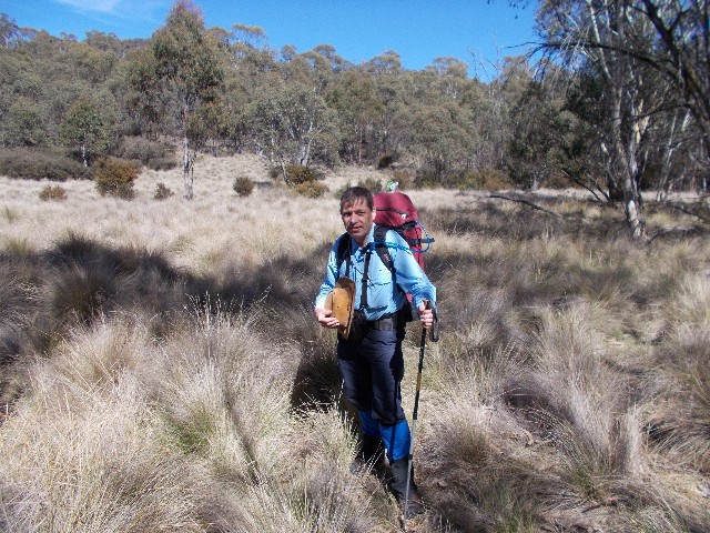
Paul stands in the thick grass amid the Orroral River Valley. Photo: S Sunley
The other reasons for putting on this walk was that I was interested in purchasing a Hilleberg Atko tent and Sean had one in his collection. I wished to purchase one of these Swedish made tents online, but was cautious about spending the money having not had the chance to try out the tent or seen how it pitches and handles the conditions beforehand. Sean was willing to allow me to use his tent on this hike so I could make this decision. Craig was also having issues with his new Macpac Microlight tent and wanted to try and fix this problem with the help of two friends who have owned Macpac tents in the past.
On the morning of Saturday 27th October, Sean drove from his home in Wagga Wagga and picked Craig and myself up from Craig's home in Gordon just after Midday. We had a short 40 minute drive south along the Naas Road to the Orroral Valley. It was a warm, sunny spring day with temperatures expected to drop overnight followed by sunny clear conditions on Sunday with a slight cool breeze. Perfect hiking and camping conditions.
Paul stands in the thick grass amid the Orroral River Valley. Photo: S Sunley
Our plan was to follow the Australian Alps Walking Track (AAWT) north west on the western side of the Orroral River before continuing on to the campsite we had used in 2017. The following morning we would cross the Orroral River and return to the picnic area on the lesser known eastern side of the river, thus hopefully creating a new Sub 24 hour walk and what we found was a most enjoyable and scenic walk that no one else really knows about. This circuit of course cannot be confused with the 'Orroral Valley Circuit', a walk that takes in Orroral Camping Area, Nursery Swamp Car Park and Orroral Homestead.
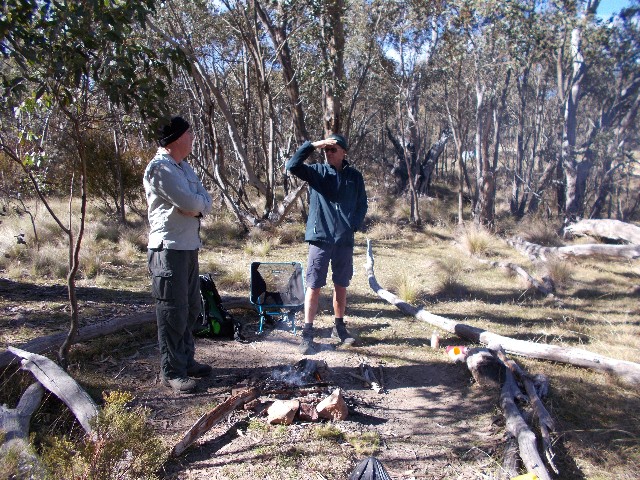
At the car park we put on our boots and gaiters (for possible protection against snakes). My boots were my new untried Keen Gypsum Mid II boots that I had been having lots of issues with. I'm hoping that the walk, with the weight of my fully laden rucksack (at 17Kg exactly) will show that these boots are indeed what I needed for a multi day walk. At first they felt tight around the mid foot but there appeared to be room around my toes which had been the issue on previous walks where my other boots were so narrow my toes were crushed up against each other causing painful problems. The heel area also appeared to be quite comfortable too.
At 1.00pm we set off through the picnic area, crossing the concrete footprints of the old demolished buildings and radio dishes and crossed a field in a northerly direction. I was surprised to see we weren't following the official road and foot track at this point and it was obvious that Sean did not want to spend very much time walking on unsealed dirt roads. We crossed an old fenceline and made our way across the grass towards a weather station on a small rise before continuing cross country towards what is known as the Link Trail. There were Eastern Grey Kangaroos everywhere and they all hopped away at our approach.
We quickly arrived at the Link Trail. This narrow dirt road takes you to a concrete bridge crossing the Orroral River before steeply ascending the ridge to link up with Honeysuckle Creek Campsite on the AAWT. Where we arrived on the trail was perfect as straight in front of us was a signpost revealing the Alps Walking Track heading north-west. It was no more than a regularly mowed grass track which makes its way across the valley before the AAWT diverts south west again after about 2 kilometres at a track intersection which was once the site of an old homestead - long since ruined and now little remains.
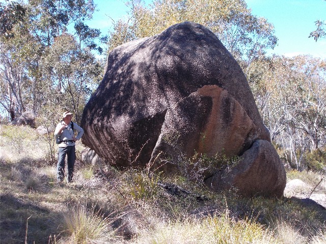
Sean is dwarfed by one of the large granite boulders found in the valley
We continue on north west, stopping occasionally to take photographs of the valley framed by large boulder strewn ridges on each side. The panorama is quite splendid and in today's brilliant weather, makes the walk all that much more enjoyable. We chat about our recent adventures that includes the Hume and Hovell Trek, bushwalks on the south coast and Sean's cross country skiing trips and cycling tours. We stop after one hour next to some boulders just off the track in the shade for a quick refreshment before continuing. The Orroral River is a few hundred metres across the countryside, noticeable only by the channel cutting through the old paddocks. The track is mostly level with very little ascending or descending for most of its length.
I'm quite surprised to find there are no issues with my new boots. They appear to be quite comfortable and the tightness around the middle of my feet has dissipated. I'm enjoying the ability to wriggle my toes but concerned that at times they do bash up against the front of the boot. The track now becomes a little more defined rather than just a mowed channel through the scrub. There is no hurry and we are enjoying a pleasant walk through the valley, even with heavy rucksacks on our backs.
The track now makes its way through an outcrop of trees and Sean and I recognise this section from our previous walk here coming from the north. We soon arrive at the wooden footbridge on Sawpit Creek and ascend the track to meet up with the Smokers Trail, a long unsealed forest road that comes in from Corin Dam Road high up on the escarpment and later meets up with Cotter Hut Road which takes you back to the Orroral Valley Tracking Station Picnic Area. This was an original option for our return tomorrow, but there are much better ways of returning than following a long boring stretch of dirt road.
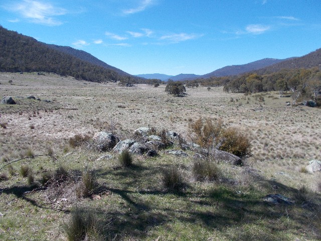
View looking south down the Orroral River Valley
We estimated that today's walk is about 8km long. Sean's GPS tracker later provided the figure of 9.5km and for Craig, this is about his limit when walking full pack. Craig was starting to slow down and admitted "Hitting the wall" at around 6km. We slowed down to assist and when we found ourselves well ahead, stopped to allow Craig to catch up and get a breather before carrying on. We are now following the Smokers Trail northward to our campsite located in a grassy section not far from where the trail crossed the Orroral River on a small bridge before ascending ridiculously steeply to Smokers Flat. We now have a small ascent through forest for a short distance and Sean doesn't remember this section of road, though I do and remember the fallen tree we had to negotiate. We pass that spot noting the tree now in small pieces on the roadside courtesy of someone's chainsaw.
About 1500 metres after leaving the track at Sawpit Creek we descend gradually to an area of open countryside on both sides of the road surrounded by native forest. Sean and I recognise the camping spots we used last year immediately and we drop packs. A check of the time reveals it is just after 4.00pm. We walk down to the campfire area in the forest to find it much as we remembered it, including having to negotiate the old fallen tree to reach the communal fireplace. There is one spot for a tent in this area, but the campfire area is still surrounded by old logs. Then we return to the rucksacks to set up the tents. Sean chooses to pitch on the western side of the road while Craig and I choose the eastern section and get busy pitching tents.
First I assist Craig with his Macpac Microlight. The issue with this tent has been that water has been getting in during wet weather and it appears that the fly at one end is cut shorter than it should be, thus revealing a small section of inner tent to the elements and getting Craig's feet and sleeping bag wet. I thought there may be an issue with the connection between the inner and outer tents where two eyelets hold the one pole at ground level. They don't appear to match up and the way this tent is connected is much different to my old Microlight. When Sean finished pitching his tent he came over and had a look but could not work out why the fly was not reaching ground level when pitched. He too has come to the conclusion that the tent fly was badly cut during the making process.
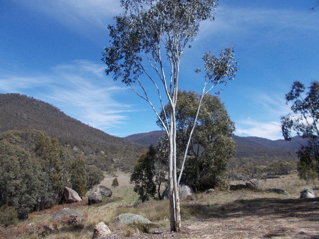
View looking north west up the Orroral River Valley
Sean now turned to assist me with the pitching of his Hilleberg Atko. Sean had packed it with the optional footprint and the mesh inner rather than the regular inner, considering the present temperatures. Opening up the tent I located the two ends and pegged them out, then put together the main pole and fed it through the hoop and locked it in. With Sean's help he then showed me how to peg the guy ropes and tighten everything up. Unzipping the outer revealed the inner tent and it's door zips. Opening it all up and placing my sleeping mat inside which just fit. Sean was amazed at the size of my sleeping mat. It barely fit inside the Hilleberg and Sean stated it was no wonder the mat did not fit inside my Marmot Tungsten one person tent. It was huge - 2 metres long, 65cm wide and 9cm deep. This was one of the reasons I now prefer to buy online only after checking equipment in the field first, with the help of other walkers who have that brand of gear. The Exped mat was bought sight unseen and although very comfortable, provides problems using it with one person tents. Sean suggested I get inside the tent to get an idea of how much room I have and asked me to sit up, pretend I was using a stove in the vestibule and move around. I found I had plenty of room and was quite satisfied with the space options. Sean showed the air vents on ends of the tent and at the top. The Atko has a reputation of being a tent that is very bad with condensation. Tonight's sleep will answer that question. In the hot afternoon sun the tent was very warm and obviously the dark green colour of the fly, though great for so called 'Stealth Camping' does tend to attract the heat. It's probably good that the mesh inner is being used this weekend rather than the regular. It's also obvious with a normal mat there will be a little more head room, though that is not a big issue.
After setting up the bedding we move our cooking gear, food and seating down to where the campfire is situated. Craig has already started gathering firewood. I make the short 100 metres stroll to the bridge over the river to collect cooking water. The river here is very narrow, barely a stream, but the water is cool and crystal clear. I fill my water bag and head back up the hill to the campfire just as everyone else gets there with their gear and firewood. I look around and add extra firewood to the pile then set up my folding camp stool and get out my Optimus pot and stove set to brew up a late afternoon cuppa.
Sean and Craig at the campfire at Orroral Camp
We sit around chatting, enjoying the fact we have daylight saving in force, so an extra hour of daylight. After cooking and eating our respective dinners we clean up and await the setting sun before lighting the campfire. Even at 8pm there is still light in the valley. The fire is lit and the wood piled on. I later discovered much to my annoyance that an ember from the fire had landed on my brand new Exofficio bushwalking shirt and burned 2 holes in the sleeve. First time I've used it. The annoyance is that the shirt is not cheap at well over $100 retail and this never happens to the $20 shirts that I've often purchased and used. from now on I set my seat well away from the campfire.
As it gets dark and cool Sean retires to his tent. Craig and I stay by the fire until it burns down to embers and then we too retire to our respective tents at around 9.45pm. I notice we are pitched under a clear night sky and there is no breeze tonight. This is really going to test the condensation factor on all of our tents. The night was very cool and almost too cold - certainly it was much colder than the 2 degrees forecast we were given. Tonight was definitely well below zero. I woke up several times during the night, but was just comfortable with the conditions.
I woke up just before 7.00am next morning and the Hilleberg was already warming up with the sun rising on the tent and to me it looked like there was hardly any condensation on the Atko at all, though as I exited the tent I found why. Although the tent fly at the entrance was quite wet, once outside I noticed the grass was covered in frost and there was ice on the top of the tents. I grabbed my food bags and made my way to the campfire where I was quickly joined by Craig and Sean and the campfire was soon lit as we made our breakfasts. We had plenty of time on hour hands this morning and we could just enjoy the morning sun while it dried off the tents. We stood around the campfire chatting away until well after 9.00am when we put out the fire and headed back to our tents to pack up. Again we took our time and Sean assisted me with the final wrapping up of the Hilleberg. I was won over. I think the Atko will make the perfect tent for major multi day hiking, especially in the cooler months. I have other tents I can use for the shorter 2-3 day hikes, but owning a Hilleberg will be like having the choice of several cars in the garage with the Atko being the Aston Martin at the back.
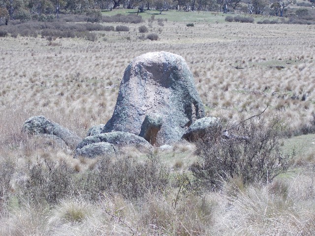
Tortoise Rock
At 10.00am we set off back to the car. We followed a faint track behind where Sean had pitched his tent which took us down to the Orroral River and we crossed over, very easily as it was no bigger than the stream I had gathered my water at the bridge yesterday. Now we had quite a bush bash through forest as we made our way back south towards the Orroral River Bridge on the AAWT near the picnic area. We were soon working up a sweat as we negotiated the bushland and undulating countryside. Eventually, after one kilometre, we came out onto an open grassy plain dominated by rock outcrops and heavy tufted grass mounds. We had to be careful of snakes here as they often curl up around the base of these tufts and await their prey.
The plain was untracked, but easy to walk across and some of the rock outcrops were quite photogenic. We zig-zagged our way through the grass tufts soon coming to an open grassy area that looked like it would have made a great campsite, then we descended a low rise to Booroomba Creek and found this had crystal clear flowing water. Craig washed his face and Sean took a drink. I still had plenty of water in my hydration bag. We crossed over the creek and surprisingly located a foot track that took us some distance across grassland and forest before again disappearing and reappearing in small sections. We found it best to keep as close to the Orroral River as possible, but that created problems when we found what we thought was a track but turned out to be nothing more than an animal pad as it stopped abruptly at the water's edge.
We passed by rock boulders that apparently had names, such as 'Big Boy' and one we named ourselves, called 'The Tortoise'. Some more track location was required in places and I now noticed that my left ankle was rubbing on my new boots. This ceased as soon as we returned to walking on defined track and road, which is a concern, but overall the boots were great and caused very little problems on this walk. We located a track that soon became what was left of an old dirt farm road and followed this for a short distance. At times we caught fresh cool gusts of wind which did their job of cooling us down.
The road became more defined as we passed near what appeared to be one very large boulder, easily the size of a large house, but too far away and tree interrupted to get a good photograph. Suddenly through the trees we saw the Orroral River Bridge, crossed over and followed the Link Trail to where we had come out yesterday. All that was left was to cut across country back to the picnic area - easy to see by the deciduous trees there which stand out against the native Eucalypts. We crossed the old fence at the same spot as yesterday and arrived back at the car park at 1.30pm. According to Sean's GPS we had walked 8.5km today, one kilometre shorter than the walk in which is obviously explained by the winding trail yesterday and the generally straight line off track we had walked today.
Overall we had succeeded in what we wanted to do. We have
found another great Sub 24 hour bushwalk, one that should delight walkers
in the club for quite some time. I also found that my new boots proved
themselves worthy of multi day walking, though still unsure on their off-track
capabilities. I was very impressed with Sean's Hilleberg Atko and as soon
as I got home I ordered mine (due to the green being unavailable I settled
on the red model) from one of the online hiking stores. As for Craig's
tent problem, he may need to get in contact with Macpac to sort out what
is wrong with it. Overall, a most enjoyable weekend away in the Namadgi.