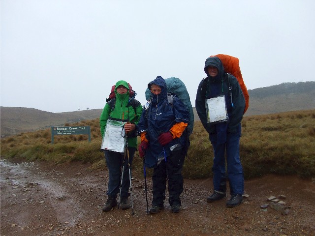
Rugged up from the weather prior to starting the walk at Kiandra. L-R Paul, Els and Wayne
On Monday 11th November 2013 with return driver Glenyce in tow, I picked up Els from her home in Flynn and Wayne from his home in Latham. We drove out in the morning rain from Canberra and drove along the Monaro Highway to Cooma, then on to Adaminaby and eventually Kiandra where we would commence our walk. We planned on walking the Australian Alps Walking Track (AAWT) all the way to Tharwa and in planning this walk I estimated it would take us about 8-10 days to complete if we utilised the rest day and took all side trips to points of interest. This certainly was in my original plans. It didn't necessarily mean this would eventuate.
The Australian Alps Walking Track covers three Australian states, the A.C.T., NSW and Victoria. The track travels 655km from Walhalla north of Melbourne, to Tharwa, just south of Canberra. To walk the track end to end it would take around 6 weeks of walking and require several pre-planned food drops. The track traverses the highest sections of several National Parks within the three states, including Kosciuszko National Park. Although many have walked the entire track from end to end, most hikers walk the track in 5-10 day sections, 2 day hikes or one day bushwalks. The section I plan to walk has been completed in as little as 6 days.
Rugged up from the weather prior to starting the walk at Kiandra. L-R Paul, Els and Wayne
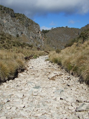
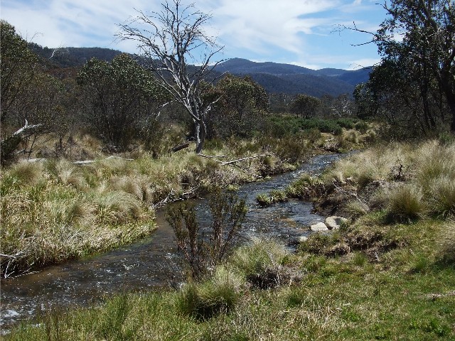
As we neared Kiandra the weather took a turn for the worst. We had all seen the weather forecast that informed us the first two days would be walked in wet rainy conditions, but what we saw was snow. Kiandra is now nothing much more than a ghost town of ruined buildings, though some are now being rebuilt. Kiandra was once a gold mining town that had fallen on hard times. Situated halfway between Tumut and Cooma, it is the gateway to the NSW snowfields. We arrived at our destination at 10.40am next to Nungar Creek Trail 600 metres north from the old Kiandra Courthouse. I parked the car at the side of the road and we got out to put our rucksacks and raincoats on. By the time I was ready my hands were frozen cold. I was really pleased I had packed a pair of gloves, for the first time in over 10 years I actually got to use them. My rucksack had been weighed in this morning at just over 18kg, possibly the lightest I had ever packed this rucksack. Most of the gear packed was my lightest possible as 10 days worth of food was going to take up a big percentage of the pack weight. Luckily we were able to utilise a food drop during the walk to keep the weight down.
Glenyce took the opportunity to take a group photograph of us at the start of our trek, and what a miserable looking trio we were, rugged up to the nines in our waterproof jackets standing there trying to look enthusiastic in the middle of a snowstorm and about to head into the wilderness. We needed our heads read. AtÝ10.50am I said my farewells to Glen and we headed down the trail to Bullocks Head Creek and its intersection with the Eucumbene River 300 metres below the road. Glen later told me she waited a little longer because Els looked like she was torn between the decision to join me and Wayne, or jump back into the car with her and go home. She waited beside the road for 20 minutes before deciding to head back to Canberra after noticing Els had indeed followed us.
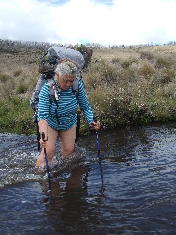
Now the fun really started. We not only had to cross Bullocks Head Creek, but just over 50 metres later, cross the Eucumbene River. This meant removing our boots and socks, rolling our trousers over our knees, putting on our wading sandals (or 'crocs') and wading through knee high freezing cold water. By the time I reached the opposite side of the Eucumbene my feet were totally numb and almost blue from the cold. My gloves were soaking wet from the heavy rain that pelted down on us. Had I known that Glen was still parked on the roadside above the trail I would have been sorely tempted to head back as fast as my cold feet could take me. Already 30 minutes had passed since we had left the car and started on our walk and most of this had been taken up with removing footwear for the crossings and then putting everything back on.
I waited for Els to cross the Eucumbene before heading uphill to follow Wayne on the trail north-eastwards on Nungar Creek Trail as it ascended a cold bare hillside that gave us views of distant snow covered hills in the distance. The rain continued to fall, stop and become snow, then changed to sleet before becoming rain again. The ground was pock marked with patches of white. However, despite the cold I felt quite comfortable, the raincoat was keeping me dry, the gloves, despite being soaked were keeping my hands warm and despite the fact I had not put on my wet weather pants, my hiking trousers were wet, but not cold and I knew they would dry quickly. My feet were not as cold as I thought they would be after the crossing and I suddenly felt very comfortable in my surroundings. I only had to put on my fleece beanie under my parka to keep my head a little bit warmer and that was done at our first break.
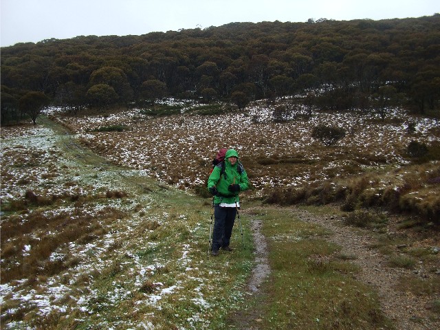
Paul finds himself in snow during the walk near Dead Horse Plain
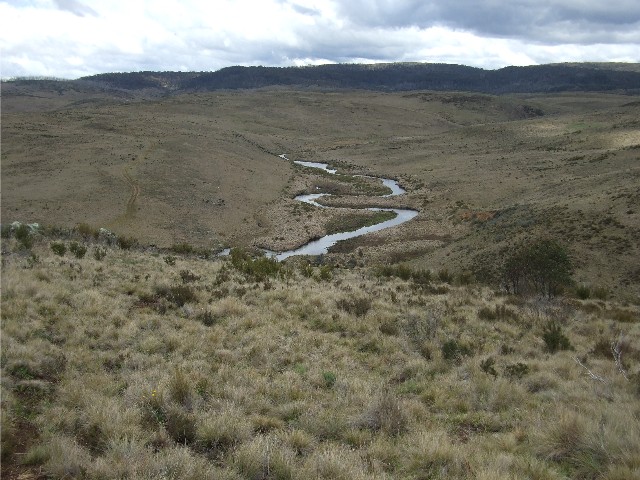
As we reached the top of the first hill we could make out the roads, bridges and other features of Kiandra and it looked quite bleak, but picturesque. We now descended to Wild Horse Plain, another open expanse of almost tree-less wilderness and crossed Chance Creek. We had spied a couple of Brumbies (Wild Horses) near the trail and had seen the clumps of ice that had been removed from their hooves.
Ascending a small hill on the great dividing range we stopped for a snack break at the top in the shelter of some snow gums for a few minutes before we descended to the Tantangara Creek plain and the intersection with the Alpine Creek Trail. Turning left we headed in a northward direction. By now the rain had eased considerably, but it was still bitterly cold. We noticed several rabbits in the paddocks as we passed by and the trails were covered in Brumby droppings, the horses using them to mark their territory. Several kangaroos were also seen.
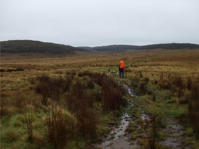
Wayne makes his way across Dead Horse Plain
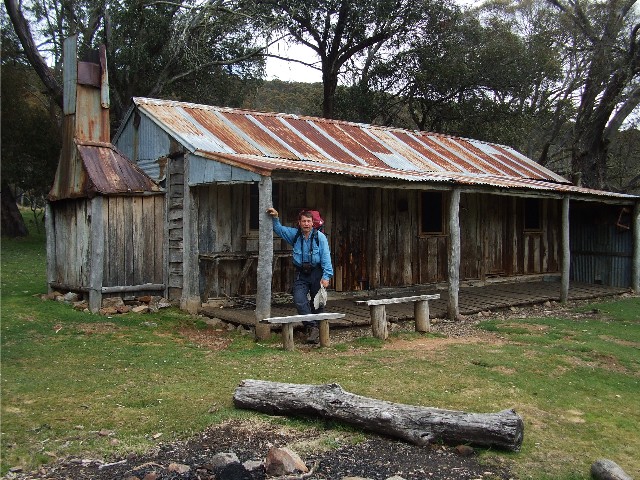
We crossed over Tantangara Creek and started ascending gradually up a hill. The rain briefly stopped and we even got to see a small welcome patch of blue sky, but within minutes the cloud cover was back and the rain returned. We soon expected to see our destination for the day, Witzes Hut, but each bend revealed more green pasture dominated by snow gums, but eventually we came around a small bend in the trail and there was the hut. We had arrived at 3.00pm. It had taken us just over 4 hours to cover the 12.5km distance from the start. Witzes Hut is a slab hut, built during the 1950's from materials salvaged from a previous homestead built here in the 1880's. The name 'Witzes' is apparently a corruption on the name 'White', a builder of the original house. The hut has vertical adzed slabs with a stone hearth and corrugated iron chimney. Over the years the slabs have shrunk, creating gaps to the outside world, but still a comfortable alternative to camping outside in the elements and we all decided that camping inside the hut would be an excellent alternative for the night.
Wayne got a fire started and soon the fireplace was festooned with wet gloves, socks and various items of damp clothing hanging from a length of wire. We organised our sleeping spots in the one-room hut, using our rolled out tents as floor coverings and our packs and equipment to keep out the cold wind where the gaps in the walls were. To the east of the hut only 100 metres away was a small fast flowing creek that provided all of our water while a drop toilet was located behind the hut. During the afternoon the rain stopped and the sky briefly cleared. We watched as rabbits frolicked in the grass around the hut. Wayne had organised his bedding underneath the huge wooden table at one side of the hut - he was set for a very cozy night. By 6.00pm we had cooked and eaten our respective dinners and wary of the day ahead, decided on early nights. By 7.15pm we were all snug in our sleeping bags. I slept very well, despite the heavy rain that pounded on the roof of the hut from 11.00pm to well into the morning.
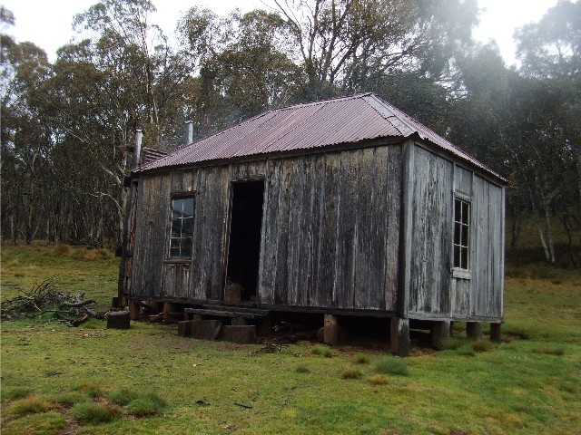
Witzes Hut, our end to the first day of walking
Tuesday November 12th saw us all up as soon as the rain stopped at 6.20am and preparing our breakfasts. We wasted little time this morning as we had a long hard day ahead of us. We had consumed breakfast, packed our rucksacks and cleaned the hut and moved out onto the trail by 7.50am. The sky was still very cloudy and we were all dressed in our wet weather parkas and rain proof trousers.
Just 600 metres east of Witzes Hut we turned left and headed north onto Bullocks Hill Fire Trail which crossed Blanket Plain. The trail is still winding its way through open grasslands dotted with the occasional stands of snow gums, although we have now left the snow behind us. We stopped for our first break at 9.20am at a spot some 600 metres north of the track intersection to Haines Hut (definitely not on our checklist as it is just a corrugated iron fishing hut on the Murrumbidgee River 2.5km away) By now the sun was breaking through the clouds and patches of blue were appearing everywhere. It wouldnít be long before the cloud had all but disappeared. I took the opportunity to remove my wet weather pants, but kept my raincoat on as the wind was still quite strong and chilly.
The track now descended gradually to what we believed was the Murrumbidgee River (it was in fact Tantangara Creek which flowed into the Murrumbidgee close by) The ford across the creek was running fast and deep after the recent heavy rain plus spring snow melt and looked too dangerous to cross here, so we wandered westward along the bank for almost a kilometre before we noticed a spot that looked safe. It was still reasonably deep and running fast, but the other option was that we could follow this creek for many kilometres before finding a suitable spot.
Wayne was first to go, borrowing one of my trekking poles for balance and had got only a couple of steps when he slipped over, getting his camera wet, almost losing my pole and in the process losing one of his sandals. We watched helpless as the 'Croc' sailed quickly downstream in the torrent. Wayne regained his balance with some effort and crossed to the other side. At least we can now say there are 'Crocs' in the Murrumbidgee River. I was next and I found the force of the water quite frightening though it wasn't as cold as the Eucumbene yesterday. The current was extremely strong and it took quite some effort to spread my legs out and use my pole for balance, digging it as hard as I could into the riverbed. Each step threatened to upend me and send me careering downstream and I was thankful I had remembered to leave the hip belt of my rucksack unbuckled, making it easier to remove the pack should I end up underwater, a distinct possibility here. Slowly but surely I stepped my way to the far bank and with some relief stepped on hard dry ground.
Els attempts to cross a flooded Tantangara Creek
I looked back to see Els having trouble with her first steps into the raging torrent. Without thinking I dropped my pack and went back in to help and encourage her across the creek. I stood in the middle with the force of the water trying to push me downstream. Els was stepping bit by bit and didn't seem to hear me when I suggested she spread herself better and used her poles for grip. I was amazed she made it without incident. I returned to my rucksack and dried off, putting on my socks, boots and gaiters for the cross country section of long tussock grass that was obviously snake infested. Already Wayne and Els had started across and I rushed to catch them up.
We now followed a dirt road uphill for 500 metres before turning right and following a trail downhill towards some hills in the north. It was here that we crossed onto our next map which would explain our mistake of thinking we had crossed the Murrumbidgee. Standing at the bottom of those hills was the mighty Murrumbidgee River and it was flowing deeper and faster than the creek we had just crossed. On the other side Wayne had spotted the biggest snake he had ever seen and was not keen to be heading that way. We wandered back and forth looking for a suitable place to cross. We couldn't believe it, after all the trouble we had just gone through to cross Tantangara Creek and now we were faced with something that looked deeper and faster. The area we concentrated onÝ appeared to include two islands in the middle of the river but each crossing looked too deep and fast. It looked like we were going nowhere and I think none of us wanted to head further upstream where Wayne had seen the large snake. There was a camping area here and it was obvious that others had used this spot to camp out and wait until the river level had dropped. I started wandering downstream and found a spot that was narrow where a side creek flowed in off the hill.
The only problem was that once on the other side I would be required to cross a swampy area full of large (probably snake infested) grass tussocks to get back to the main track. For extra purchase on the river bed I refused to remove my boots and gaiters and stepped in. The water was cold but quite refreshing, but like the Tantangara, the water force was quite potent and it took some difficulty getting across. The water here came only up to my knees, but it was enough, With some relief I stepped up onto the far bank, then gingerly made my way back through the long grass to opposite where Wayne and Els were attempting to cross. They had got as far as the first island before finding the water too deep and fast to cross to the next stage. I signalled to where I had crossed and both made their way down there.
I watched from a distance halfway up the ridge as first Wayne then Els made the crossing. I could see Els was again having trouble and Wayne went back in to assist her. He told me later what happened next. Wayne had told Els to spread her feet to get a better balance against the force of the water, but she wouldn't listen. She had almost reached the bank when she went in backside first, rucksack and all. Worst still, her rucksack hip belt had been buckled up. Els was in danger of being pulled down river by the force of the water. It took a great effort from Wayne to get her up on her feet and drag her to the bank where she proceeded to dry herself off. A near disaster had just been averted. Els was taking her time getting herself sorted so Wayne suggested I head off up the ridge and find an open sunny spot for us to take lunch.
The Murrumbidgee River, taken after I had crossed and waited for Wayne and Els from up on the ridge
There was no track to speak of but I kept looking back downhill to make sure I could see Wayne. This was to become another mistake in a day full of mishaps. We broke the cardinal rule of splitting up, no matter how innocent it seemed. I got to the top of the ridge to find open tree covered countryside. However, the track notes stated we should follow a footpad alongside a small creek. I made my way down a small incline to see the creek and saw a small footpad that appeared to peter out after 100 metres. I then made my way back to the top of the ridge expecting to see Wayne and Els making their way towards me. No such luck. I waited for about 15 minutes before deciding to head back to the Murrumbidgee River where I had last seen them. I reached the spot where I had last seen Wayne and Els and there was no sign of them. I wondered how they had got past me, then I saw the faint track along the creek side and decided to follow this as it headed north. It was obvious that my companions had taken this route and I had obviously just missed them when I had checked the creek out from above. To let them know I was catching up I started blowing on my whistle every 50 metres and soon enough heard a whistle in reply. I continued blowing and hearing a reply until Wayne and Els appeared on a tree covered knoll. We agreed the decision to split up was a wrong one and something we would not repeat, not with only three of us in the group.
Time was getting on and at 1.45pm we stopped for a lunch break at the top of a short ascent under some trees. As we continued after lunch the track veered to the right a little and continued. Where did this well defined track go to? Why was it here? How could be be more well defined than the AAWT? Every couple hundred metres I would stop and check my GPS and checking the contours of the topographic map against the lie of the land. We soon returned back in open country and the spot we were supposed to cross was quite obvious and I was soon standing exactly opposite where we had to cross. The topographic map showed a defined track crossing the creek here but there was no marked track on the ground at all. We had indeed earlier crossed a small arm of Dairymans Creek. The side track was interesting enough and on another day would be worth following to check it out.
We now crossed Dairymans Creek and headed north using my compass. Wayne and Els wanted to camp by the creek for the night, stating it was getting late in the afternoon. It certainly was, but as we had a long day ahead of us tomorrow which required us to be at Blue Waterholes in the afternoon to meet our food drop, I felt we needed to make it to at Least either Ghost Gully Camping Area or Hainsworth Hut tonight to get a good start next morning. I suggested we just battle along as best as possible. We also had two more major off track navigation decisions to make and I wanted them out of the way and they involved the telegraph poles. After crossing Dairymans Creek we were to ascent the open grassy hill to a tree covered saddle where the first of a series of unused telegraph poles stood. These poles were once part of a telephone line that once connected the Old Currango Homestead to the now ruined Rules Point Hotel.
Wayne now excitedly pointed to a shape in the distance. It was the unmistakeable shape of a telegraph pole. We were definitely on track. We followed each pole in a north easterly direction until, after about 1.5 kilometres we reached the last telegraph pole. Now we headed downhill on a north easterly then northerly bearing until we reached the unsealed Port Phillip Trail. Somehow we had missed the faint track in the long grass and stepped out onto the road about 1km west of where we should have. I didn't care, the important thing was that we had finally conquered the untracked section of the trail and finally made it to somewhere easy to navigate after such a long hard day, but it wasn't all over yet. It was almost 6.00pm.
There was no way we would make it the extra 3.5km to Hainsworth Hut this afternoon, well, we could, but not without the risk of mutiny from Els or Wayne. Admittedly even I was very tired and my shoulders were very sore from the rucksack and my feet were tired. Even Wayne looked totally exhausted and Els was plodding away like a trooper at the back. As we followed Port Phillip Trail to the east the sky got darker, a storm was coming. We passed the spot where the AAWT supposedly came out onto the road (Signs at Dairymans Creek and beyond would have been more helpful) and alongside this the trail to Millers Hut. We had considered a side trip to see this corrugated Iron hut, but today's long walking had certainly put paid to that idea. We now continued uphill after crossing the bridge on Bally Creek and soon expected to see Ghost Gully Camping Area just after the track intersection for the Mosquito Creek Fire Trail - which we would be following tomorrow. It was a bit further than we expected, at the end of a very long and tiring day the 1.5kms felt more like 10. Eventually, at 6.20pm we passed Mosquito Creek Fire Trail turn-off and there, on the other side of the Port Phillip Fire Trail, was Ghost Gully Campsite.
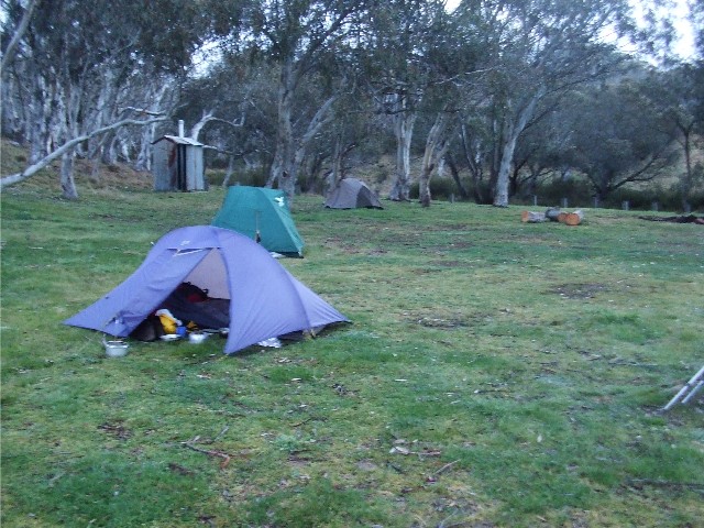
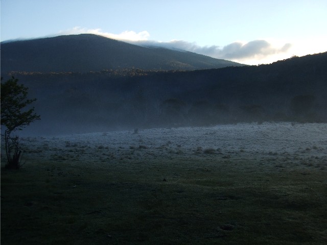
Our campsite at Ghost Gully after the storm passed over
Elated, we selected a spot to drop our packs. The camping area was low grassed had a selection of snow gums. A small creek to the west provided water and there was a clean drop toilet to the south. The grass was low due to the large amount of rabbits in the area. Their droppings as common as the brumbies. We wasted little time getting our tents pitched. I'd no sooner got my tent out of the pack than the storm hit us and rain started to fall. This was quickly followed by the distant rumblings of thunder coming our way. The electrical storm bypassed us. The rest of my equipment was still in my rucksack. I now moved everything into the tent and set up my bedding, then started to prepare my dinner. Before I realised it I was the last person still up. I finished my dinner, washed my utensils and retired to my sleeping bag at the late time of 8.15pm. I woke one hour later to the sound of heavy rain on my tent. This continued for about 3 hours on and off and I started to think that packing up next morning was going to be rather fun - NOT.
Wednesday 13th November I was up at 6.30am. Despite the overnight rain I had slept quite well. I exited the tent to find it covered with ice and the ground white with frost. Wayne and Els were up very shortly afterwards. The sky was clearing and the sun was attempting to break through the light clouds. I hoped it would hurry up so it could melt the ice on my tent then dry it off. When the sun rays did hit they were quite warm, I busied myself with breakfast and organised my gear ready for packing once the tent was ready. I also checked out the track notes and map for today's walking. I was shocked enough to discover we had what appeared to be a very long day ahead of us. My track notes stated about 24km, but that included the possible side trips to points of interest. Els pointed out that according to her track notes, the distance was only 18km. This was due to the fact that she had not included side tracks as none of these were of interest to her. Els notes were also taken from Hainsworth Hut some 3.5km away, so this made, according to her calculations, a day's walking of around 21km with no side trips.
Because of the length of walking today, and especially after the day we had yesterday, we decided to get going as early as possible. This meant that I had to get my tent as dry as I could before packing. As it was, it was still rather damp when I was left with no choice but to pack up. Els tent had been covered with ice too, but hers was in a sunnier spot than mine. Wayne had been camped under the cover of some snow gums and had no ice on his tent this morning. At 7.55am we left the Ghost Gully Camping Area and set off along the Mosquito Creek Fire Trail. The weather had become overcast again and had become quite windy. I decided to walk wearing my raincoat and beanie, though it wasn't cold enough for gloves here.
Keeping our pace up a bit must have worked because we arrived at the turn-off for Hainsworth Hut within 30 minutes of leaving Ghost Gully. No one else was interested in walking the 300 metres to the hut and I wasn't interested in splitting up again and walking 600 metres just for a hut photograph - another "next time". I was also very keen to get as many kilometres out of the way as possible. The Mosquito Creek Fire Trail wound its way along open plains and through forest. More brumbies were seen on the trail ahead of us and they always bolted at our approach. Dodging the piles of droppings on the track became a regular event. We had a short break at the side of the trail and found why this trail was so named as swarms of mosquitoes suddenly appeared. It wasn't a long break.
Just after we started walking again the rain started, not heavy, but enough to have us zipping up the parkas and donning hoods. We passed the turn-off for the Old Currango Homestead. Again I was really interested in the 4km round side-trip as I'd heard the old homestead was worth visiting, unfortunately my companions were just not as interested as I and again the combination of having to walk that distance alone - with no one to take photographs of me at the hut, plus the rain had me regrettably agreeing to continue along the trail. We then crossed Morris Creek and then followed the trail through a gap in the Gurrangorambla Range finishing at Blue Waterholes Saddle that is situated between two large hills, a long way from Blue Waterholes and it is situated at the head of Cooleman Plain, a large expanse of clear almost treeless rolling grasslands. Wayne and I noticed what appeared to be a campsite with tracks going every which way. We thought ìNot Againî but it was obvious we couldn't take the wrong trail here. I certainly wasn't going to take any risks and vowed to get out the GPS at the first opportunity.
After a long flat trail and crossing a small creek I noticed a corrugated iron hut to my left and a track heading towards it. Wayne informed me that this was Bill Jones Hut. It was exactly Midday and I called for lunch break. Bill Jones Hut is situated on the western edge of Cooleman Plain on a series of triangular track junctions that form Mosquito Creek Fire Trail and Harris Hut Trail. Harris Hut is now nothing more than a ruin several kilometres north of Bill Jones Hut. The hut we now looked at is situated in the middle of a flat green lawn now used as a camping area. Unfortunately the hut itself has nothing more than a dusty dirt floor and looked in a state of disrepair compared to other huts we had seen in the Alps. This hut was built during the 1950's. It had a food safe that somebody had stocked up with unwanted food items during their travels and there was a hut logbook which I wrote in. I was amazed to find that the hut had been visited every day for the past week, including a group that had walked in from Canberra only two days prior - it turned out they were on horseback. It was also obvious the camping area outside had been utilised. The sun had come out by now, but dark clouds were still on the periphery and it was still very windy. We all kept our wet weather jackets on for the next section of walk.
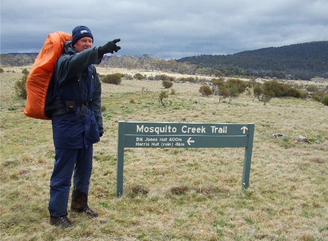
Wayne stands beside the Mosquito Creek Fire Trail sign at the Harris Hut Trail intersection just after lunch
35 minutes later we were heading back to the track where I took a GPS reading to confirm our location. Of course we had missed our side track by just 100 metres and Wayne was quick to locate it. 300 metres later we came to a National Parks sign that confirmed we were still on the Australian Alps Walking Track. We now followed Harris Hut Track across Cooleman Plain for just over one kilometre, arriving at the Blue Waterholes Fire Trail immediately after crossing Seventeen Flat Creek. Again we were astounded at how quickly we had covered the distances today. It was almost as if we had over-compensated for a long hard day then found the walking easier than expected. On the topographic map Mosquito Creek Fire Trail winds its way through the terrain for many kilometres yet we covered the distance before lunchtime.
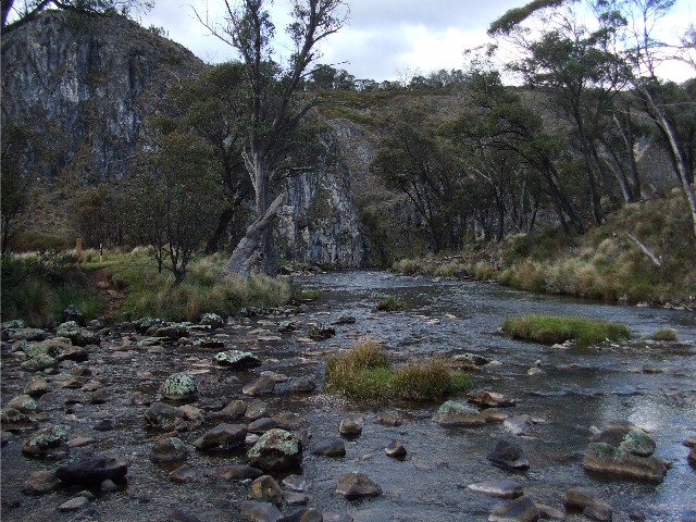
We now followed Blue Waterholes Fire Trail northwards across rolling fields bordered by trees. Along here was the biggest populations of brumbies we had ever seen. There was literally a herd to be seen around every bend in the trail and despite the obvious hordes of hikers that frequent the area the horses are still skittish enough to gallop away at out approach with the dominant males standing their ground between the females and us and snorting and stamping their hooves before running off to join their herds. There was a large kangaroo population too. Soon the track started to descend into gorge-like country that was dominated by large limestone outcrops. We were now entering the Cooleman Caves/Blue Waterholes area which was to be our planned destination for the next two nights.
Nicole Creek Gorge near Blue Waterholes/Cooleman Caves area
We crossed a dry creek bed that had a signpost telling us it was the Nicole Gorge Walking Track. The dry creeks in this area are caused by the underground limestone cave formations draining the water in all but flood conditions, giving the creeks a 'desert-like' quality. In some cases the water re-appears as if by magic several hundred metres downstream. We cross another dry creek twice. I was looking forward to exploring this area this afternoon or tomorrow, but had to be wary of the many sinkholes that dominate this picturesque region. We now ascended a short hill and suddenly found ourselves passing a camping area next to a lookout and then a dirt road that included a camping area complete with a very modern looking toilet block, arriving at 2.30pm, much earlier than originally expected.
The camping area was extremely crappy, all uneven ground, though it had picnic tables and benches and fireplaces. We decided that perhaps we should move to the spot next to the lookout, but signs on the gates to the Blue Waterholes/Cooleman Caves area stated "No Camping Beyond This Point". We had no choice but to pitch on the uneven ground where we could. We all found our spots and started to pitch our tents. My tent was still very damp from this morning, but in the afternoon sunshine and strong winds it took just minutes to dry. Despite having a modern looking toilet block at this campsite there was no sign of any water tank. We had crossed 2 creeks completely dry and the topographic map showed a tank at this site which had obviously been removed. I informed the others I was going for a short walk to see if I could find water. We were all getting very low. In fact, between us we didn't have enough water to make a cup of tea.
I strolled the short distance to the lower camping area and walked to the lookout. There, below me was two large fast flowing creeks of crystal clear water. I had found the official Blue Waterholes where a side creek joins the main waterway before it travelled through Clarke Gorge. I went back with my news. We were also wondering when Chris and Cynthia would arrive with our food drop. Would it be this afternoon or tomorrow morning? The original plans were that Chris and Cynthia would join us for a day's walking tomorrow through Clarke Gorge to Cave Creek and back to try Nicole Gorge. Cynthia had originally put her name down to come along on the hike but work commitments had forced her to withdraw. On the eve of the hike those plans had again changed, but too late for Cynthia to prepare her equipment and food in time to join us.
We decided to gather our own water considering that we had all walked enough so far today and it was deemed unfair to expect one person to go down to the creek for the others. I dragged out my little pocket pack which would perfectly fit my hydration bag and my wine bladder then set off for the creek. I quickly found a foot track leading down to where the two creeks merged. Stepping stones crossed both creeks for walkers to utilise to reach the foot tracks that followed the creeks to points of interest. I filled my water bags from the side creek then made my way back to the camping area. I then remembered I needed to wash some dirty clothing and returned to the main creek to wash them downstream from where we would collect our water. Returning to camp with the wet clothes I set up my washing line between my two trekking poles. It worked perfectly. Wayne had gathered his water and had retired to his tent for a rest. Els had just gone down to collect her water when I heard the sound of a car.
It was 4.30pm and Chris and Cynthia had arrived with our food drop. Unfortunately the news wasn't good. Cynthia was required at work next morning, so their plans to camp for two nights and walk with us tomorrow were thwarted. The food drop was most welcome though. It contained most of the food I would require for the last 4 days of the hike, plus extra batteries and a few comfort foods. However, with at least a couple of days reduced I now realised I would not need every meal and was able to return some food items. Wayne had packed all his hiking food with him, but had included lots of comfort food into his food drop. Smart boy - a large bottle of Coke, A packet of chips and some chocolate. Wayne was suddenly my best friend for the afternoon.Ý
Of course the other part of the food drop was put on in case any of us wished to drop out of the hiking trip at this point. Wayne had considered doing this on a couple of occasions during some of our more difficult moments, but it was Els who took this option up right now. Els, despite being a very competant bushwalker had struggled along the trails, her pace was much slower than myself and Wayne and she was often serveral hundred metres behind us. This meant that Wayne and I had to constantly stop to either allow her to catch up, or at least have us in her line of sight. It became very hard for Wayne and I to get a decent walking rhythm up and obviously hard for Els to constantly be looking at our backs from 200 metres behind. Els had done a lot of solo walking in her time, especially in places such as western Australia's Bibbulmun Track and had obviously managed pretty well. It must have been a bit of a shock to her to suddenly find herself following two gazelles on very long walking distances. Wayne, who had walked the track in the past had stated his concerns considering the track from here on included much harder walking and had dropped hints to Els that maybe she should consider taking the option to pull out at the food drop. She had obviously listened to him and considered the options. I think she made the right decision. We were going to miss her on the rest of the track but there would always be other walks for her. While Els was packing up Wayne and I filled Chris and Cynthia in on how the walk had gone so far. The main reason they had offered the food drop was that they thought Els might struggle on the walk and would accept the chance to pull out early on. If she didn't then the food drop would work in lowering rucksack weights considerably for the first 3 days. By 5.00pm we had bid a sad farewell to Els as she got in the car and Chris & Cynthia drove her home.
Before I cooked my dinner I decided to take a short walk. Wayne had already seen most of this area and was not overly keen to do it again. The idea now was to head off towards Oldfields Hut tomorrow instead of hanging around here the extra day. I strolled over to the lookout and found a foot track that descended to the main creek, passing a spot where the water suddenly appeared from underground. Behind this spot the creek bed was still very barren. I was now strolling through the Blue Waterholes area which was dominated by eroded limestone caves in the cliffs above. It was very peaceful and serene here with just the sound of water rushing along cascades. The track followed a small peninsula of land before coming out at the intersection of the two creeks where we had gathered our water earlier. I crossed over and decided I should leave the rest of the interesting scenery until next time.
The intersection of the two creeks at the Blue Waterholes area looking down towards Clarke Gorge
I cooked up my meal and arranged my sleeping gear as the setting sun shone over the limestone cliffs and hillsides in front of my tent. I thought I had picked the best possible spot to pitch my tent. Wayne hadn't. Later that night he was woken by a loud noise outside his tent. It was a large brumby stallion that had taken a dislike to Wayne's tent being pitched across his pathway. Wayne said the snorting and hoof stamping went on for quite some time and he had genuine fears of being stomped on during the night. wayne considered a quick dash out of the tent for safety under the picnic table 10 metres away, but knew that was just too far. He had no choice but to stay where he was and eventually the stallion retreated.
Thursday 14th November and I was up very early with a stiff back from a rare uncomfortable night's sleep. I exited my tent again to find the outer fly totally frozen in ice and the ground crunching under my feet. It was bloody cold too. The sky above was totally clear with just a few clouds over the tops of the hills to the north east. Unfortunately that's where the sun came up and it slowed the melting of the ice on my tent and then the evaporation of water. The picnic table was also frozen, but the concrete base was useful to organise all my gear while I waited for the tent to dry. wayne didn't take long to stir and told me of his encounter during the night. While we got breakfast and organised our equipment we watched as a mob of kangaroos approached. One, with a joey in her pouch came very close to where we were camped and was obviously very used to being around campers.
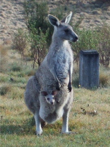
Kangaroo and joey visit us at the Blue Waterholes camping area
By 8.50am we had managed to pack our rucksacks and set off on the trail back to the Harris Hut Track intersection. The brumbies were out and one stallion in particular took an interest in Wayne, stamping its feet and snorting. Could this horse smell Wayne's tent from last night? We ascended out of the Cooleman Caves/Blue Waterholes area, turning around only once to make sure there was no Els behind us and we continued on. Within 40 minutes we were back at the intersection with Harris Hut Track and continued heading south-east through more open country alongside Seventeen Flat Creek. More brumbies were seen as were mobs of kangaroos. The track then ascended gradually through forest to a saddle north of Howells Peak. After descending for about 300 metres we came to a side track where Wayne wanted to adjust his boots.
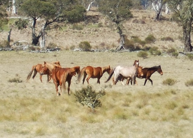
Wild Brumbies on Cooleman Plain
A sign post informed us that Pocket Hut was just 600 metres away. Wayne wasn't interested in taking a look but I was, and being such a short detour I decided to head over. The trail made its way through an open paddock and coming round a bend I saw this excellent red-brown painted timber hut. The first thing I did was walk around the hut. Again theÝ grassy grounds were kangaroo munched short and it looked like there was a shortish walk down the hill to the creek for water. One side of the hut had a 44Ý gallon drum full of water - to be used for fires only. A small flower garden complimented the hut and it was full of purple flowering lillies. Inside the hutwas an eye opener. It had four rooms all neat and tidy with one having a wooden futon style bed. The main kitchen had the neatest fireplace I've yet seen. Overall, this would have to be one of the best huts I've seen in the entire Australian Alps. In hindsight we could have spent the morning exploring Blue Waterholes and Cooleman Caves area before heading here in the afternoon to camp overnight, something I would consider on a future hike.
I headed back to where Wayne was waiting at the intersection and let him know what he had missed. Then we headed along the trail again, coming out onto another open plain. The track made its way around a large swamp. Ignoring a side track to the left at Pocket Saddle the trail bends round to the right and a little further on back to the left where we arrive at the Snowy Mountains Hydro valve house at the termination of the Goodradigbee Aqueduct. We had excellent views of the peaks surrounding this valley, many of them we had no idea what they were called and most were too far away to be on our maps, but we gathered that two of the peaks were BimberiÝ Peak (A.C.T.'s tallest mountain) and Mt Murray - the pass between these two we would be negotiating tomorrow on the border between NSW and the ACT.
Now I needed to stop to check my feet. I had a small blister on one of my toes and I needed to adjust my sock. Thankfully we didn't have far to go before we reached our destination today and just as well. We both required a half day rest. My rucksack was getting very sore on my shoulders and I needed to make some adjustments. The trail started to ascend gradually into more forest and we then saw a sign telling us we had reached Murrays Gap Trail. We ignored all other tracks heading off this. The trail now ascended steeply up to the top of this ridge. It was very steep, easily the hardest ascent we had experienced on the entire walk so far and we were not enjoying this at all with our sore feet and shoulders. I found the best way to tackle this was to attempt to walk 100 metres and then stop to catch my breath and allow my heart rate to settle before continuing the next 100 metres or so. Each time I picked out a dominant tree and aimed to stop after passing it. Each bend in the track we came to revealed yet another ascent. As we were having great difficulty with this I wondered how Els would have gone had she not opted out last night, this ascent was not nice.Ý
Eventually we came over the top and the track now descended almost as steeply on the other side. As we descended to an open plain Wayne pointed to the distance. Sitting on the edge of the plain was the unmistakeable sight of Oldfields Hut. We quickly made our way over to it. I had been looking forward to seeing this hut on the trip as I had seen many photographs of it and it is a fine example of bush architecture. Built in the 1920's it has three rooms and a verandah with some of the best mountain views in the park. Water can be gathered from the Goodradigbee River to the east or from a water tank at the far side of the hut. In front of the hut is a grass lawn, kept low by Kangaroos, Wallabies and rabbits and an old vegetable garden that still has carrots growing. This is surrounded by a selection of fruit trees.
Wayne and I had arrived there at exactly 12.15pm. We wasted little time in dropping our heavy rucksacks and preparing to have lunch and relax all afternoon. However, within 10 minutes I heard the sound of a horse and looked over to see a high country rider bringing his horse down the trail. He was followed my more and more horses and riders including several children on horseback. We introduced ourselves and the group turned out to be originally from all over the state. They had gathered for a planned wedding yesterday right here at Oldfields Hut, but the gates had been closed to vehicles due to the recent heavy rain, so the wedding was held elsewhere. The riders were amazed we were walking the Alps Walking Track.
Paul stands outside Oldfields Hut
We settled down for lunch and then had a look around the area. Another two riders turned up - this place was busier than Sydney at peak hour. These latest were not involved with the other group but were aware of them. They had been for a ride up to Murrays Gap and informed us of the track conditions up there - which were a little boggy but not too bad at all. As we settled down for the afternoon we organised our rooms and placed our bedding and cooking gear. It was starting to get quite cool in the afternoon so Wayne got the hut's fire lit. Suddenly there was a commotion as the possum that was sleeping in the chimney suddenly made a noisy exit up the metal chute and onto the roof. He obniously did not like smoke. Wayne, concerned the possum was heading for the gap in the roof above his room rushed to block it off, then started pelting the possum with small stones to get it away from the hut, but it scrambled under the eave over the verandah and got itself stuck between the metal roof and verandah beam. We decided to let it stay there for now, at least until we had eaten.
We now sat outside enjoying the views of Bimberi Peak from the verandah. A flock of four Gang Gang Cockatoos flew over and we were centre of attention by several inquisitive kangaroos (complete with joeys in pouches) and wallabies, though none came too close. The grass here was obviously of the finest quality. Around 6pm we cooked our dinners inside. The fire in the hut kept us nice and warm. I got my iphone out and checked the battery - it had hardly used any power over the past 4 days. I couldn't resist the urge to go into my phone's MP3 player and select something by Mike Oldfield considering where we were at present. Just before retiring to my bed at 7.15pm I managed to assist freeing the possum. I should have left him where he was until morning. At around 10.30pm I was woken by an almighty screeching noise. The fire had obviously gone out and Mr Possum was coming back down the chimney. The noise of it scrambling across the kitchen would have woken the dead. I turned my head torch on and there standing on the top of the wall dividing my room from the kitchen was a large possum. Telling it to "Get Lost" didn't work so I grabbed one of my trekking poles and banged it on the floorboards. That worked, the possum disappeared - for a while. About 10 minutes later I had to repeat my actions as the possum had another go. It worked again and I fell asleep.
I was woken some time later to find the possum making its way across the top of the wall at the front of my room. It was obviously heading for wayne's room. As soon as my head torch shone on it the possum stopped. Again I banged my trekking pole on the floorboards until it crossed right over to Wayne's room. I called out to Wayne that he had a 'Visitor' then lay back and listened to the show next door. I found out exactly what happened next morning. Wayne had jumped out of his sleeping bag and thrown a sandal at the possum - which had perched itself on top of the food safe there. The first sandal missed, but the 2nd one didn't, hitting the possum on the head. Wayne held the door open and the Possum made a dash for freedom, but not quick enough as Wayne slapped it over the rump with his bag of tent poles. I fell asleep after that and wasn't disturbed, but Wayne tells me two possums were having a fight on the roof before everything went quiet. When I woke next morning I noticed that there was fresh possum poo on the floor of my room. Lucky I kept my food in my rucksack which was my makeshift pillow. Poor Wayne, that's two nights running he's had encounters with the local wildlife. The Grizzly Adams of the Canberra Bushwalkers?
Friday 15th November I awoke at 6.00am to a clear blue sky, ice on the grass and mist over the slopes on Bimberi Peak. It looked like it was going to be a fine sunny day. As Wayne exited his room the sun shone on the hut and next thing I knew was I had a waterfall coming off roof as the ice turned to water. We packed up our gear, put our rucksacks on and headed out the door at the early time of 7.45am. The rucksack felt quite comfortable on my shoulders for once. Our plans today were to get at least as far as Cotter Gap where there was a campsite and see what time it was before deciding whether to move on or not. That was quite some distance away and included at least two decent ascents.
Looking across the plain from Oldfields Hut through the morning mist and frost towards Bimberi Peak
The first was to Murrays gap, though it certainly wasn't as steep or long as yesterday killer. First though we had to cross the Goodradigbee River. The water was crystal clear and probably the finest we'd seen on the entire walk so far. Wayne was quite surprised to find there was now a bridge across the river where there had been none back in the 1980's. Now we started ascending through the forested slopes of the gully between Bimberi Peak and Mt Murray. A whole series of ascents and they weren't half as bad as yesterday. We crossed two very fast running creeks - in between these was the impressive Black Sallee camping area (also known as Dunn's Flat) - another very suitable spot to pitch tents should one be coming through here towards the end of the day. We arrived at Murrays Gap camping area at exactly 9.00am - just 4km and a decent ascent from Oldfields Hut and stopped here for a short break. It looked like the camping area here was quite good with room for at least four tents.
I asked Wayne if he was interested in going to the top of Bimberi Peak. Wayne had already been up there in the past and was not keen to ascend to the top again. There was no point in me going up alone as there would be no one to take the obligatory Trig photograph at the top and there would always be another time. It seems I'll be putting this walk on again just to do all the interesting side trips. After 10 minutes we moved off again heading for the Cotter Valley. There were still some minor ascents, but the real test was the extremely steep descent that starts just on the south side of Little Bimberi and finishes over 300 metres below in just over 3kms. I was really glad I was travelling towards Canberra and so not having to ascend this horror. The descent itself was very tough on the knees. We were now walking through thick forest but as we entered the Cotter River Valley we came to more open grassland.
At 10.25am we arrived at the intersection with the Yaouk Trail and the track opened up. We had excellent views of Coronet Peak to the north east. Following the trail now as it headed north we passed remnants of trees burned in the 2003 bushfires and some of them had interesting shapes to their trunks. We arrived at Cotter Hut at 10.45am and stopped for morning tea here. Amazing to think that five days ago we were looking to make this area an overnight camping site, having obtained a free permit to camp in the area from NPWS.
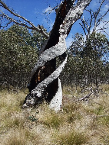
Remnants of a tree burned during bushfires - I found the twisting trunk rather interesting
At this rate Wayne believed we would make Cotter Gap (our planned overnight stop) by lunchtime. Still it was now a very hot day and the sky was almost cloudless. The flies were a menace. The entire valley was surrounded by impressive looking mountains and plateaus, most of them we had no idea of names, many of them not even on our topographic maps. The valley was green and nice and peaceful. Cotter Hut itself is just a fibro dwelling used as an office by the water catchment authority. There was no shortage of water tanks here, despite the Cotter River running close by.
After a 15 minute break we followed the trail north for about 200 metres before turning right onto a faint side track to cross the Cotter River via a ford. Unlike previous river crossings on the walk, crossing this was easy, We didn't even bother changing our footwear. The water came up just above the ankles at its deepest point. My feet didn't even get wet. On the other side we were greeted by a herd of inquisitive kangaroos who eventually hopped away as we walked closer. The trail now began to ascend, though only gradually. It made for delightful walking with views of the valley between the trees on one side and the slopes of Coronet Peak on the other. The track was quite long and just kept ascending. We passed Pond Creek Flats, once noted as a suitable camping area but now badly overgrown. At 12.10pm we stopped at the side of the track for a 30 minute lunch break, having found two very handy fallen tree logs to sit on. Wayne felt we were only about 2.5km from Cotter Gap and the worst of the climb was still ahead of us.
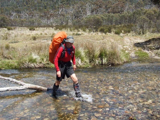
Wayne crosses the Cotter River
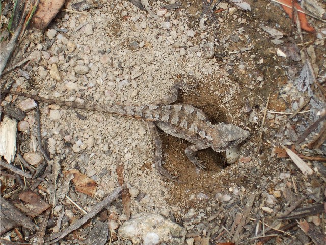
He wasn't wrong. Almost immediately after resuming the ascent, the track suddenly got steeper, and steeper still. We agreed that this last section of the ascent was steeper than the section to Oldfields Hut though shorter in length. In the heat of midday the sweat was pouring out of us. I almost stepped on a Cunninghams Skink sitting in the middle of the track. These lizards are about the same size as a large Bluetongue and similarly marked, only the have a longer tail and pointier head. We also started to enter what is known as boulder country with large granite boulders scattered either side of the track. The ascent was becoming tiring and we were getting tetchy as each bend in the track would reveal another section of steep ascent. It probably wasn't that bad, it had just been a hard day so far in the heat and we had enjoyed mainly descending and a gradual ascent to lunch.
Eventually, at 1.30pm we arrived at Cotter Gap. It was hard to miss, we had come out on a flat plateau and the area was dominated by a large granite boulder beside the track that we had seen a photograph of in the guidebook. The camping sites were rather overgrown and didn't look very inviting, but by this stage Wayne had already suggested that we could make the Orroral Valley Camping Area by late afternoon. This site had modern drop toilets, Tap water and covered shelters, and it was mostly downhill all the way. It sounded too good to be true, but it also looked like we would then be walking out at Tharwa by tomorrow afternoon, three days ahead of schedule, we had really covered some distance today. The distance remaining would be just 23km and we would have covered 27km by the end of today.
A view up the Cotter River Valley
We started to descend to the Cotter Hut Road, the first descent was quite steep and it came out on Sawpit Creek where, unseen by us was another camping area. We found another lizard on the track, this one a very tiny water dragon and noticed it was guarding a small hole complete with eggs. Wayne was now complaining of a troublesome ankle and he was finding it very hard to walk comfortably. He asked me to see if I could get a reception on my iPhone. Wayne had suddenly decided he'd had enough hiking for one week and stated that if we could get his wife on the phone she could come and pick us up from Orroral Valley Camp tonight, or at worst tomorrow morning. He felt there was no way he could continue with his ankle in such pain. Unfortunately I could not get a decent phone signal.
At 2.45pm we arrived at a dirt road. This was the Cotter Hut Road and turned left. By now my feet were sore, I was starting to chafe and there was a very sore spot on my lower back where my rucksack's harness system was rubbing. In reality we had pushed ourselves much too hard in the heat today. Perhaps we should have taken things a little easier, camped earlier on the trail and then we would have been fine to continue next morning.
Tiny lizard protecting its eggs on the Australian Alps Walking Track near Cotter Gap
As we came around a bend in the road 15 minutes and one kilometre later we both noticed another bushwalker standing on the road's edge having a drink. We introduced ourselves to Marshall, a public servant from Canberra who had finished work early that day to do a spot of bushwalking. We told him what we had been doing and when Wayne asked him if he had a mobile phone with coverage, Marshall offered not to just get a phone call out, but he offered to drive us into Canberra this very evening. The only catch was that he wanted to complete his bushwalk first. He informed us that his vehicle was at the Camping area car park. If we were still there when he got back he would have no problems driving us out. We thanked him and continued down the road.
Somewhere along the road we suddenly came to an intersection that was signposted with Australian Alps Walking Track markers. This was the link track that we would normally follow to take us to Honeysuckle Creek and eventually Tharwa. I was almost temped to turn here and leave Wayne to finish his walk at Orroral Valley. However, I had no idea where the next campsite was and my sores were hurting, In some hope I was thinking maybe after a night at Orroral Valley Camp we would be okay enough to come back and finish the walk tomorrow. It was not to be. The dirt road continued for several kilometres and suddenly I had no desire to back track along this road to reach this intersection and continue tomorrow, refreshed or any day.
It now seemed like this road would never end. Wayne had been here many years before, but his memories were vague at best, especially when the next bend would reveal the track to the old Orroral Valley Tracking Station and the road continued onwards. I felt this was a very sad end to what had been so far a great hiking trip, but we couldn't help old injuries and weary feet. Eventually we found a track (part of The Orroral Heritage Trail) on the left side of the road and followed it the couple hundred metres to the Orroral Tracking Station Picnic Area. Arriving there at 3.55pm. I wasted little time getting my rucksack off my back and boots and socks off my feet. My toes were red and angry and my ankles had heat rash. The rash would take almost a week to vanish. Wayne and I both had a cup of Hydrolyte solution I had carried in my rucksack. Looking at the map of the area there are some great tracks around here. If not utilised as a day walk the option could be to include them on a future hike on the AAWT.
We hadn't been sitting down 30 minutes when Marshall turned up. He had easily reached his destination and had come quickly back. He rearranged his campervan and then drove us back into Canberra where Wayne's wife would be waiting to drive us home. A different finish to the walk than I had originally planned.